
Who’s Really Aboard The Money Train?
- Edwin Preble
- Apr 4
- 5 min read

The answer may surprise some readers.
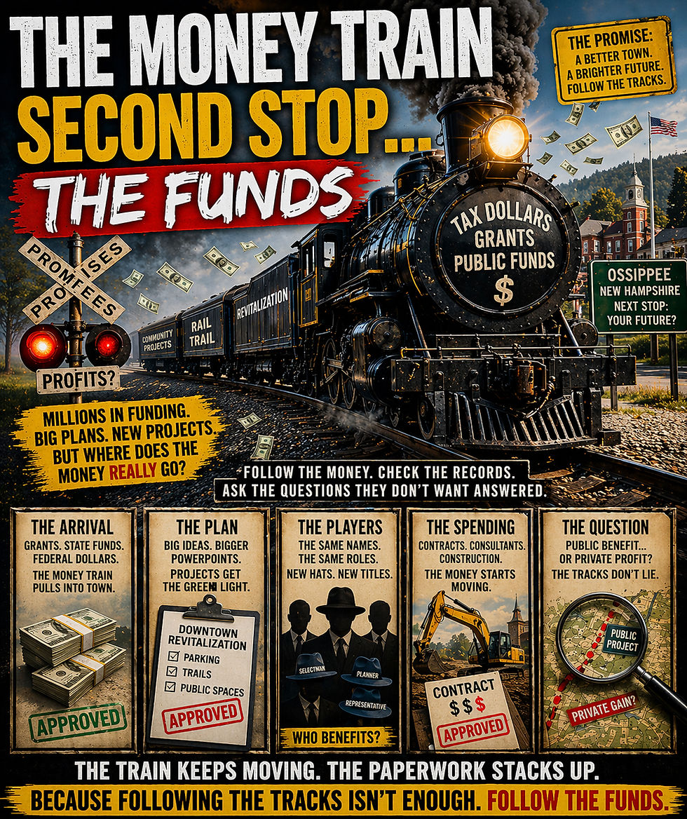
In Ossipee, we do not just wear a lot of hats. We stack them like cordwood and call it governance.
One minute it is “community revitalization.” The next minute a Main Street building is headed for the great parking lot in the sky.
Not because parking is some desperate public emergency. Nobody has been wandering downtown with a sandwich board reading MORE ASPHALT NOW. No, this is because the rail-trail money train is pulling into town — figuratively, of course, since the actual train has already been replaced by planning meetings, corridor memos, and enough overlapping titles to make a business card cry.
And that is where this starts sounding less like planning and more like a very polite property-value scavenger hunt.
The public record already tells a pretty plain story. After funding for the revitalization group was voted in during March 2024, May special-meeting planning board minutes show Jonathan Smith saying the addition of about 20 public parking spaces at 15 Moultonville Road, also called the Main Street Building, was being driven by the expected rail trail. In that same discussion, he said that, as a state representative, he had a bill for a rail trail going north, had spoken with the Deputy Commissioner of NHDOT, and that the rail trail was likely going to happen. He then stated that, based on the rail trail and the current status for Center Ossipee, that was the driving force for parking.
That is already a pretty remarkable sentence for a town that often acts like these things just sort of happen naturally, like mud season or tax bills with ambition.
Translated into plain English:
“Come enjoy downtown. We removed part of downtown so you can park for it.”
That is not Main Street.
That is Brake Street.
And Jonathan Smith is not exactly a one-hat operation. Public records and town pages show him wearing multiple official hats at once, including town-level roles and state-level office. So when people ask whether there are overlapping roles here, the answer is not “maybe.”
The answer is: enough hats to open a Lids franchise.
Now add Mark McConkey to the cast.
Public records place Mark in state government, transportation-related discussions, prior land-use circles, and the broader orbit of local planning, including ties to the Main Street revitalization group when it started. And that matters because the trail is not just some cheerful little bike path floating over town like a Hallmark drone shot.
Trails change land value.
They change access.
They change traffic.
They change where people stop.
They change where people park.
They change which parcel becomes “the gateway.”
And they change which nearby landowners and businesses get the foot traffic while the public gets the ribbon cutting and a speech about community.
That is why owning land along Route 16 and beside a railroad corridor that is being turned into a rail trail can be a very nice private benefit wrapped in very wholesome public packaging.
It is the municipal version of saying,
“This is for everyone,”
while quietly checking whether “everyone” includes your frontage.
And the corridor issue is not theoretical.
The documents already in hand include a state memo showing NHDOT sought approval to sell a piece of the state-owned Conway Branch Railroad Corridor to Mark McConkey as an abutter. Other public trail records show him involved in, or thanked in relation to, the corridor process. So this is not corkboard-and-yarn territory. There are actual documents, actual corridor records, actual public roles, and actual property ties in the same area.
That does not automatically prove wrongdoing.
But it absolutely gives the public a reason to notice when the same general circle keeps showing up around:
Main Street
land use
transportation
corridor planning
parking
and property near the future trail
That is where the red flags start waving harder than the ones on a windy day at the Right Price lot on Route 16.
The first red flag is the public project, private bump problem. If public officials or close associates own parcels along the corridor, then decisions about trailheads, crossings, parking, visibility, and access can quietly increase the usefulness and value of nearby private land. Not every parcel benefits equally. The parcel near the entrance, near the lot, near the crossing, or near the commercial corner is not just “by the trail.” It can become the trail’s unofficial cash register.
The second is the Main Street boomerang. Ossipee spent years promoting revitalization, identity, and downtown improvement. So people are allowed to ask a very basic question: if Main Street was sold as revitalization, why does one practical result now look like flattening part of Main Street for parking tied to the next corridor project?
That is not revitalization.
That is de-construction with better branding.
Or, if we are being especially charitable: placemaking with a demolition permit.
The third is the same cast, new costumes problem. When the same names keep resurfacing around revitalization, zoning, selectmen, transportation, state office, corridor planning, and nearby property records, the public is not being paranoid by noticing. That is not conspiracy. That is called reading the program before the second act.
And then there is the part that should bother anyone, no matter what side they are on.
If there was an open court case seeking to stop or preserve the building from demolition, and the building was demolished anyway, that is not the kind of thing people shrug off as routine housekeeping. To ordinary people, that looks like bulldozing first and sorting out the courtroom questions later.
Whether a court would call that contempt, evidence spoliation, or something else is for a judge to decide. But it is exactly the kind of move that makes people ask whether the process was respected at all. Because for anyone else, tearing down a disputed structure while the court is still in the picture would raise some very ugly questions very fast.
So no, this is not anti-trail.
It is not anti-progress.
It is not anti-parking.
It is pro-common-sense.
Because if the town tears down a Main Street building for parking, while the parking is justified by the rail trail, while the rail trail runs through land tied to politically connected names, while the same people keep surfacing in Main Street, transportation, and corridor records, and while a court case over the building was still open, then the public is not wrong to ask whether this train is carrying hikers…
…or hauling property value.
And around here, the old joke used to be that you cannot get there from here.
Now it feels more like this:
You can get there from here.
You just might have to park where the Main Street building used to be.

Comments